8° at the start, rising through the morning · Thin haze burning off into strong sunshine · No wind to speak of
I. The Sticky Patch
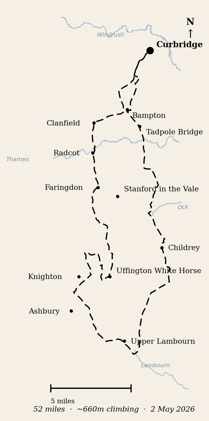
Saturday, the 2nd of May. 7:30 in the morning. A clear sky and eight degrees, with a thin haze blocking just enough of the sun that the morning warmth I had been counting on is held out of reach. I have left home a little earlier than usual, because today’s ride is a long one — fifty miles, says the plan — and I want to get the worst of it done before the world wakes up.
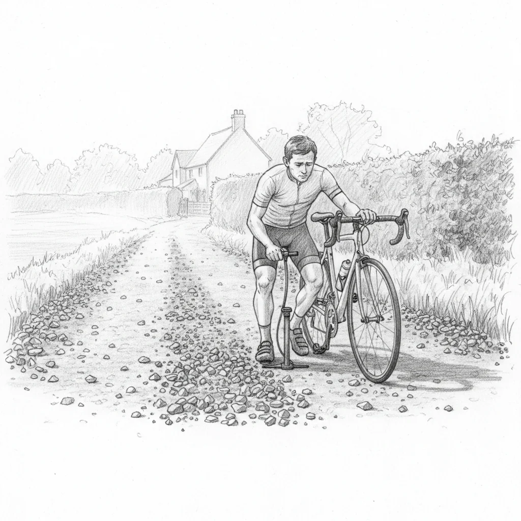
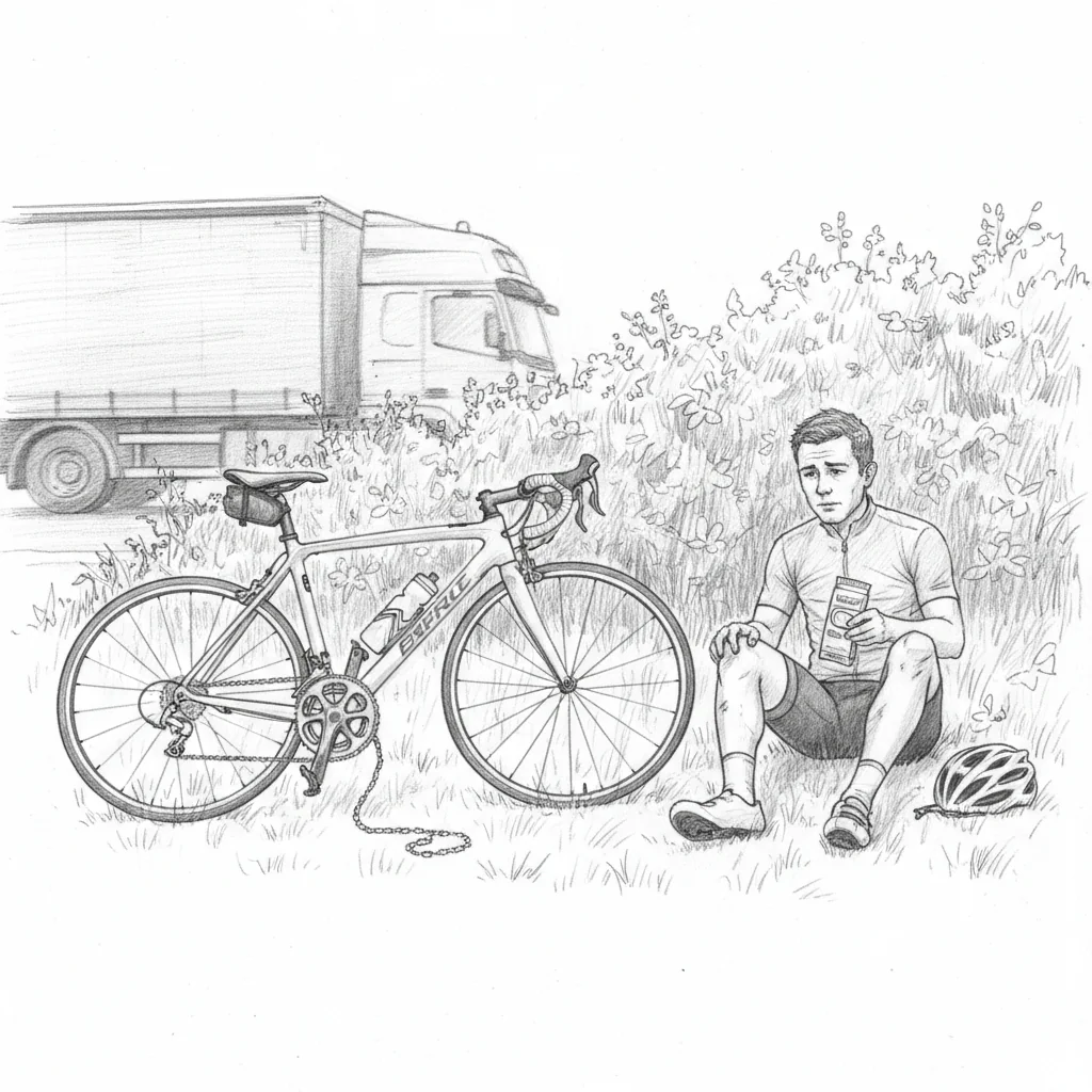
I am barely out of town and I am standing in the middle of the road in Curbridge, looking at a flat tyre.
The roadworks have been going for days. Oxfordshire County Council scheduled “highway improvement works on Curbridge Road and Bampton Road” running from the 29th of April through to the 3rd of May, and the tarmac under my feet was laid perhaps twenty-four hours ago. The chippings have not yet been pressed in by enough traffic to lock them into the asphalt, and one of them — a tiny axe-head of granite, three millimetres long, the kind of thing you would never see if you weren’t looking — has gone straight through the back tyre.
I get out my ridiculous little hand pump and a sticky patch. The shard comes out cleanly. I find the hole. I press the patch. I pump, gently, watching for the hiss that would tell me I have wasted my morning. The patch holds.
The technique I am inadvertently sampling here is called surface dressing — bitumen sprayed onto the carriageway, then peppered with granite chippings and rolled in. It is a fraction of the cost of full resurfacing, it seals the cracks, it restores skid-resistance for cars, it adds about a decade to the life of the road. Councils love it for the same reason cyclists hate it. Cycling UK’s advice is to avoid a freshly-dressed road for the first fortnight, before the chippings have settled. I have ridden onto mine on day one.
I file that thought for the way home. The way home is forty-five miles away. There will be plenty of time.
I press on.
◊
II. The Witney Hinterland
The first hill of the day is not really a hill. It is a bridge, on the lane south of Curbridge, lifting the road over a railway that no longer exists. The line was the Oxford, Witney and Fairford — Witney section opened in 1861, the extension to Fairford in 1873, absorbed into the Great Western in 1890, passenger services ended on the 18th of June 1962. It is often filed under “a Beeching cut”, and the closure had the same flavour, but the actual axe fell a little before Beeching’s report. The trackbed is hedge and tussock now. The stations are long gone. Witney has been without a railway for sixty-four years.
Charlie Maynard, the Liberal Democrat MP for Witney since the summer of 2024, has been campaigning to bring one back — not the original Fairford alignment, but a modern reconstruction joining the Cotswold Line at Yarnton. Charlie is the first non-Conservative MP this constituency has elected since 1922, and the project has been called “a fantasy” by some on the local council. He and I know each other from years of children’s football, and have spent many touchline conversations on transport policy and infrastructure investment, which is a roundabout way of saying that it was no surprise to me when he was elected as a councillor a few years ago, and even less surprising when he stood up at the general election and won. Our children have moved on from football. We hardly cross paths now.
I drop into Lew. The wind would prefer me to call it Loo, but the place’s name is older than the joke. A beautiful old farmhouse on my left has been mid-renovation for years; on my right, a pretty little church with a pointy steeple, serving five or six houses and a row of rabbits nibbling the verge. Out here it is a useful exercise to count the church-to-house ratio. It is a sad indictment of the way the parish system has thinned out, but it is also the small grace of these lanes that you will pass a thirteenth-century chancel for every dozen homes.
Just over the hedge to the south, the slope drops away and the runway of RAF Brize Norton comes into view. There is not much on the apron at this hour, and the haze is low enough that I can’t quite make out the far end. A long time ago — thirty-odd years now — I drove my then-boss and friend Sean Welsh out to Brize so he could pick up a military flight to the Falklands, on what was the start of a round-the-world trip. Sean was an inspirational boss in my early years at Amazon. I owe him a great deal: his enormous appetite for work, his task-focus, his ability to combine those things with a real care for his team. The South Atlantic airbridge has been running out of Brize since 1984 — I had half-remembered it as a service that had moved here from somewhere else, but it didn’t; it came here at the start. The C-130s that fly alongside it did move, when RAF Lyneham closed in 2011 and the Hercules fleet came across.
A quarter of an hour in. The patch is holding, the haze is thinning, and Bampton’s spire is coming into view.
Bampton is the real-life Downton. The exterior shots of the fictional village were filmed here; the wedding scenes, the christenings, the jiltings, all in the lane outside Saint Mary the Virgin — which is the church I am about to roll past, and which I had remembered all morning as Saint Michael and All Angels, wrong. The parish hall next door, Churchgate House, doubled in the series as the village hospital. For years after the show ended, coaches still came through every weekend, full of fans hunting filming locations. They still do, occasionally. Bampton is the same village it was before the cameras found it, but now it exists in two parallel histories — its real one, and its televised one.
A row of lime trees on my right has been brutally cut back over the winter to six-metre stumps. They looked terrible in February. By May, however, they are coming back beautifully — rounded green lollipops, exactly the kind of tree you would draw at primary school. Pollarding always looks like vandalism for a few months, and then it does what it was meant to do.
Bampton qualifies, in my private taxonomy, as a liveable village. Churches, plural. Pubs, plural. School, shops. Most villages out here do not.
The next one along does too. Clanfield is home to Blake’s — a third-generation family shop and post office, founded in 1965, which in 2016 added a bakery and café when Nic Blake left a university job to take the business over and reinvent it. Sixty thousand cinnamon buns came out of the Clanfield ovens in 2023, and Blake’s has become the de facto coffee stop on every cycling ride out this way. I am not, in general, a cinnamon-bun man. I am willing to take the village’s word for it. Today, in any case, we are too early. The buns are unborn. We will just have to remember the flavours, or imagine them, until next time.
Just past Blake’s, the new Adventure Plus base sits behind a smart sign — eighty acres at Windmill Farm, bought after raising close to one and a half million pounds. I first met Jon Cox, the founder, in 1997, when Adventure Plus was being run out of the attic of the church office in Cogges — the village absorbed by Witney in 1932; Cogges with an e, which I have been mispronouncing for thirty years — and I was helping him sort out printer drivers on machines that pre-dated Windows 95. Jon and I have been friends ever since. To raise money for the eventual adventure base, the two of us once brainstormed a fundraising route that ran out of Witney, looped around what is now this very land, and came back to town. They have grown bigger since — Adventure Plus now runs a six-stage, one hundred and twenty-seven-mile canoe marathon from Witney to Westminster, the longest charity canoe race in the country. I have done one stage of it, and would love, one day, to do the whole thing. There is plenty I really should do at A-Plus, and have not yet got round to. He and I are like one of those pairs of characters in a historical novel who keep almost-meeting and never quite connecting.
Out of Clanfield onto the lanes proper. Another freshly-dressed road as I head south — if I break down here, I will be at Blake’s — and a frustrated Land Rover overtakes a road sweeper a little too keenly and almost takes me out. The road sweeper, I would now like, please, on the bit of carriageway in Curbridge.
◊
III. Across the Thames
The sun has broken through the haze. The first warmth of the morning lands on my back, and I get a strong shadow on the road. A string of poplars passes on my right; a small stream pulls up alongside; and a very nice home opens up behind a smart stone wall as I drop into Radcot. I have driven this road many times, and I have never seen this house properly until today. Cycling gives you that slightly slower, slightly closer perspective.
Time to cross the Thames. Or rather, time to cross one of Radcot’s two bridges, because there are two. The medieval bridge, which my wheels are now on, was built in around 1225, in Taynton stone — the same Cotswold limestone that built the Oxford colleges — and parts of that original fabric are still in it. Radcot is often cited as the oldest bridge over the Thames. In December 1387, Robert de Vere, Earl of Oxford and favourite of Richard II, met Henry Bolingbroke here in a battle that decided which of them would, eventually, be a king of England. Bolingbroke had the centre arch removed to trap de Vere’s army, who fled. The bridge was rebuilt in 1393. The structure under my tyres is older than every parish church spire I will see today.
The Swan, beside the bridge, looks lovely in the morning light. Boats are tied up along the bank, picking up the sun. I have never lived on a boat. I have never holidayed on a boat. From this distance, on a quiet Saturday morning, it is briefly attractive.
A red light catches me, conveniently, and I take it. The hump-backed bridge is sharp enough to count as a small hill in my legs. Up over the river, under a line of pylons cutting north towards Didcot, and ahead the country lifts up onto its first proper rise — the climb into Faringdon.
A massive deer crosses the lane in front of me. Not a muntjac, which is the deer I usually see at home; this one is bigger, longer-legged, longer-necked — fallow, probably, or red. It crosses slowly enough that I have time to register it. Then it is gone.
Faringdon Folly and the squat tower of All Saints
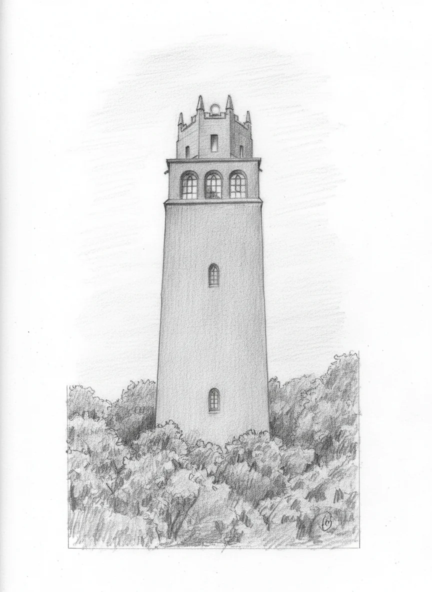
The fields up here look like they belong to a stately home — wide grass, mature trees dotted around as though arranged for the gaze of a country house, no animals in sight at this hour but the imprint of grazing ahead in the year. Then, on the skyline as I come up the hill, a tower with an unusual silhouette: brick, with a Gothic top that doesn’t quite belong to the rest. This is Faringdon Folly, the last major folly built in England: a hundred-foot tower put up in 1935 by Lord Berners, designed by his friend Lord Gerald Wellesley, with the top ten feet rebuilt in Gothic at Berners’s insistence — giving it the curious hybrid shape I am looking at. Berners built it because his neighbours had said a folly served no useful purpose. (He had previously dyed the pigeons on his estate in pastel colours, for similar reasons. There are some people who will not be told.) On a clear day you can see five counties from the top of it.
The squat tower of All Saints’, Faringdon, sits in the same picture, with a Saint George flag flying off its flat top. It looks too short for the body of its church, and that is because it is too short. The spire was destroyed in 1645, during the Civil War, when Faringdon House — a Royalist garrison — was besieged by the Parliamentarians. The tower was rebuilt without its spire, and was never restored to the height it stood before the cannon-fire took it down. A cannonball from the bombardment is on display in the east wall of the transept, which I would have seen this morning if I had stopped. The ride does not pause for tourism today.
Through Faringdon and down towards the A420 — a fast main road that I cross courtesy of a fortunate gap in the traffic, knowing it will be busy on the way home — and on through Little Coxwell. I should mention here that I am about a mile away from Great Coxwell Barn, a thirteenth-century Cistercian tithe barn that William Morris called as noble as a cathedral. He used to bring guests to it from Kelmscott. I do not detour past it. Today is about hills, not history. It will keep for a slower day.
Gorse Farm advertises milkshakes, honey, and beef on its smart sign. I would love to know how a small farm decides which three of its products to lead with. I imagine a family meeting. I imagine someone losing the argument for cheese.
The country lifts. Hill four — a small one — climbs out of the Thames basin. Ringdale Manor opens a grand gate to my left. Fernham Manor passes on my right; there are a great many manors out here, and I have to mind my manners. A signpost says Wayland’s Smithy and Uffington White Horse, and on the horizon, indistinct in the haze, the chalk ridge of the Berkshire Downs is at last beginning to make itself known. From my flatland perspective — Norfolk childhood, Oxfordshire adulthood — the rise feels almost mountainous. I know it isn’t. My legs will know it isn’t, shortly.
◊
IV. Up to the White Horse
The Beeline cycle computer on my handlebars represents gradient as a coloured bar growing uphill in front of the marker. Yellow is gentle. Orange is awkward. Red is where you start to wonder whether you should walk. The chart on the little screen for the climb in front of me looks, I realise, exactly like a classic startup sales graph: a flat near the start, a long yellow rise, a tall orange band, a small red wedge, and then the wishful flatten-off into yellow at the top. The hockey stick. The forecast almost no real company actually delivers.
Hills, unlike companies, deliver every metre.
I am on the lower foothills, between an avenue of trees, with the heart-rate monitor reading 146. The theory of a maximum heart rate is 220 minus your age — for me, around 170, give or take. I do not particularly want to learn what 175 feels like. I drop into the lowest gear I have, and start grinding. 156. Still 110 metres of climb above me. I have got to cross a junction in twenty metres and I really want not to have to stop, because stopping kills momentum and we are getting close to the moment where the engine cannot start the climb again from cold. The road turns quiet. I cross. 144.
Dragon Hill, with the White Horse above
The road steepens. 162. 166. Talking, even to myself, becomes laboured. I check the gears for a lower one. There is no lower one. To my right, a flat-topped mound rises out of the slope, fenced and conspicuous: Dragon Hill. A natural chalk knoll, levelled flat by the Dobunni Iron Age tribe, and — the folklore says — the place where Saint George slew the dragon. The bare patch of chalk on the top, where no grass grows, is supposedly the spot where the dragon’s blood spilt and poisoned the ground. Antiquarians have wondered whether it was a burial mound, perhaps even Uther Pendragon’s. I have no breath left to wonder anything.
A car comes up behind me. There is a cattle grid coming up and I have to get a bit of speed. 170. 172. Thighs burning. Heart-rate display now into the territory I had been trying to avoid. The road flattens — briefly — under a tight corner, then puts in one more steep push to the top. The lane levels off along the ridge.
I have made it. I have not had to walk.
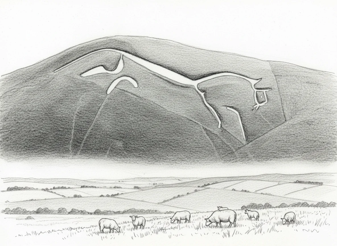
The car park I cross to is the Whitehorse Hill National Trust car park, which the Beeline insists on calling something close to Bad Shoulder, presumably a category-mistake of a place name pulled from some training set. (There is no Bad Shoulder. It is the White Horse.) I have brought the children up here many times over the years, to fly kites and to look out across what feels like half of England. North of me Oxfordshire sweeps away. Behind me, on the higher ground, the chalk-cut horse itself — one hundred and ten metres long, flowing and stylised, no plodding outline but carved as a deep trench packed with crushed chalk, dated by recent science to between 1380 and 210 BC, almost three millennia old — runs along its hill. It is the oldest chalk hill figure in Britain, and arguably the most beautiful. I cannot see it from up here. You only see it properly from below.
The Ridgeway crosses the lane at this point. It is Britain’s oldest road, eighty-seven miles from Avebury to Ivinghoe Beacon, in continuous use for five thousand years. The path runs across chalk — Upper Cretaceous, around eighty million years old, formed in a warm shallow sea from the skeletons of microscopic plankton. Earlier this morning I was on Cotswold limestone, ninety million years older than that, formed in another warm shallow sea from concentric grains called ooliths. Same conditions, different sediments. The Vale of White Horse is where the two formations meet. Today I have crossed a hundred-million-year geological seam at twelve miles an hour.
I sit for a moment on a bollard with a square of chocolate. The sheep up here are accessing something tasty on their hind legs, and the breeze that I had not noticed lower down has just made itself felt. The first hill is done. There is a long downhill ahead — and a second crossing of the Ridgeway still to do, on the way home.
Right. Off the bollard. Into the gears. Down.
Vicious.
The descent is steep enough to be on the brakes the whole way. I clip a big stone on a corner, swallow it without consequence, and head north on the road I crossed twenty minutes ago, this time in the other direction. Heart rate down to 120. A better place to start a hill.
◊
V. The Valley of the Racehorse
The road curves back south. I have looped a little further north than I intended — almost as far back as the railway line, an eight-carriage train going past behind me — and the small detour is perhaps a kindness, because it gives me longer to look at and think about the second crossing that is coming up. Maybe I just need to stare at the smooth tarmac in front and stop thinking about it.
I cross the D’Arcy Dalton Way, very nearly without noticing. It is a hundred-and-seven kilometre footpath devised by the Oxford Fieldpaths Society for its sixtieth anniversary in 1986, in honour of Colonel W. P. d’Arcy Dalton (1893–1981), who served the society for over fifty years. It runs north from Wormleighton in Warwickshire to Wayland’s Smithy on the Ridgeway — and Wayland’s Smithy is half a mile from where I just was. The path I am pedalling across, in other words, terminates at the long barrow I rode past not long ago.
Wayland’s Smithy itself is a Neolithic chambered tomb of two phases — the first built between 3590 and 3555 BC, containing fourteen people; the second a larger barrow built on top about a hundred and thirty years later. The Saxons named it after Wayland the smith, the Germanic god, and it is first attested as Weland’s Smithy in a charter of 955. Folk tradition: leave your unshod horse with a silver coin overnight at the Smithy, and find it shod in the morning. Tolkien is said to have been thinking of this place when he wrote the barrow-downs. It is the kind of landscape where a story like that comes naturally.
I see a mound to one side that is almost certainly the home of an Iron Age fort, kind of dug-up by the slow centuries into a soft set of folds, and I crawl past it — crawl being the more honest verb than power for the climb here. A mown strip of grass between an avenue of trees opens up a glimpse of a very grand house at the far end, in and then out of view in a moment. A thatched cottage. Brown ploughed fields rising up to the ridge. It is now the 2nd of May; I had thought, looking at all this empty earth, that something might be coming up by now. Maybe it is, and I cannot see it.
Hill six is a forty-two-metre puff that I had laughed at on the Beeline at the bottom and am no longer laughing at as I enter Knighton (with a K) and watch a rabbit scarper into the nettles. The hamlet is in the parish of Compton Beauchamp, three miles south-east of Shrivenham, with thatched cottages, a huge chestnut in heavy flower, and thatched barns that must be a nightmare to maintain. Like much of the Vale of White Horse, Knighton was Berkshire until the boundary changes of 1974 transferred it to Oxfordshire. Beautiful, anonymous, very still on a Saturday morning.
A nasty little incline up to a T-junction puts me on the road that skirts north of the Ridgeway, running parallel to the path itself. The shade of trees is a relief, and a light headwind reminds me that I have legs. To my right, five wind turbines turn against the southern sky — not many of those around here; the cluster is at Westmill, the old airfield near Watchfield — and beyond them, low and white in the haze, what I take to be Swindon Hospital. We are not a million miles from Swindon. Twenty-two miles into the ride and it feels like a long way out from home.
Ashbury comes up. Hill village at the western end of the Vale of White Horse, continuously inhabited for five thousand years; first recorded in 840 when King Æthelwulf of Wessex granted land at Aisshedoune — the camp of the ash trees — to a man called Duda. Saint Mary’s, on the way through, is Norman in origin, rebuilt thirteenth century. Thomas Stock pioneered the first Sunday school in England here in 1777, in the chancel.
Ashdown House, in a fold of the downs
Half a mile of orange on the Beeline. The second crossing of the Ridgeway. It is long but not as brutal as the first — heart rate 159, thirty more metres to grind out, no red. I crest. This is the North Wessex Downs National Landscape, designated an Area of Outstanding Natural Beauty in 1972 and rebranded a National Landscape in November 2023. Same legal status, new sign. Seventeen hundred square kilometres of chalk country across four counties.
I pause on the Ridgeway itself with the chocolate. It is just past 10:30. I am very pleased with myself.
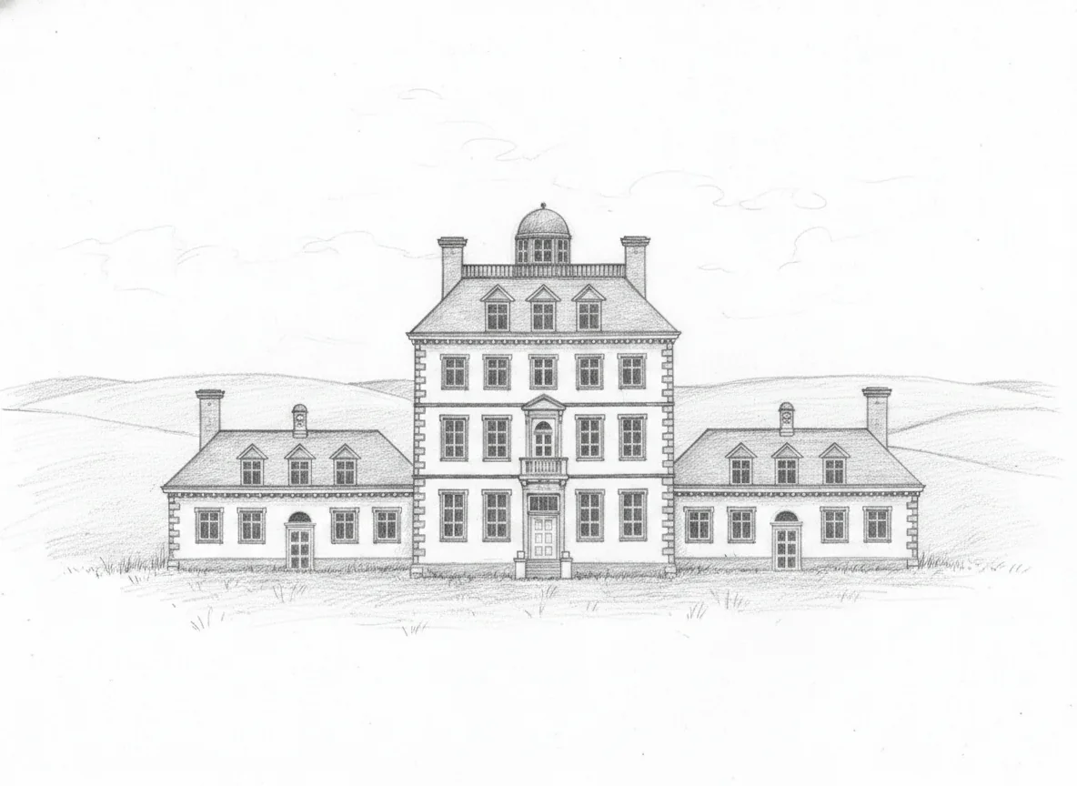
To my right, half-hidden across the folds of ground, Ashdown House — a tall, narrow, almost dolls’-house seventeenth-century mansion in pale stone, set in empty grass. William Craven, first Earl of Craven, built it in the early 1660s for Elizabeth Stuart, the Winter Queen of Bohemia, with whom he had a long unrequited devotion. She died in 1662 before he had finished it. Anglo-Dutch in style, deliberately set in an empty fold of the downland. National Trust since 1956. The “Winter Queen” was so called because she and her husband Frederick V were monarchs of Bohemia for one winter, 1619–20, before being driven into exile and a long European wandering. The melancholy of the queen is in the building’s silhouette.
To my left, a field where the farmers appear, at first glance, to be growing large boulders. I suspect, on closer inspection, that the boulders have been placed there over the centuries by people removing them from other fields. Some pieces of countryside are subtractive that way.
I cross West Berkshire. The longest single ride I have ever done was from Witney out west to near Abergavenny, to join a men’s walking weekend, and for that I cycled down and across the Severn. Twenty-seven miles into today, I am only slightly concerned to find that I am still cycling away from home. A sign tells me I am entering the Valley of the Racehorse. It is not a poetic description; Lambourn is officially marketed under that name, by the parish council and the Jockey Club. There are over fifteen hundred horses stabled in and around the village; thirty-odd training establishments; the second-largest training centre in Britain, behind only Newmarket. A fence runs along the ridgeline above me with the look of a fence built for racing or training. I see nothing but the fence. I see the idea of horses.
A hare, in a field on my left. It stops dead. I would have preferred to see it racing.
Upper Lambourn. The houses here are red brick rather than the pale Cotswold stone of home, and the smell of stables is in the air. I am, for the first time today, in country I do not really know.
The third Ridgeway crossing — Hill eight, a long sustained climb that has been going on for a couple of miles, two hours into the ride and my feet still numb in the clipless shoes — comes more gently than I had been bracing for. I had been thinking I still had a Ridgeway climb to come, when in fact I have just done it. I crest. A ten-percent downhill drops away in front of me, and as I look to the north I am seeing Oxfordshire opening out, soft and green in the mid-morning sun. The big work of the day is done. The hills are not done with me, but the hills know it, and so do my legs.
Thirty-four miles in. About twenty to go.
◊
VI. A Slow Way Home
The downhill is a long, sustained, mile-long roll — nothing dramatic, just the kind of descent that lets you rest your legs and catch your breath. A red kite slides into the corner of my vision, the first one I have seen all year, which is faintly embarrassing for an Oxfordshire cyclist. I have been head-down on the climbs.
Childrey, where I roll past a diminishing pond between two whitewashed cottages. The church, Saint Mary the Virgin, has a Norman font from the late twelfth century carved with abbots — said to be the oldest of its type. I do not stop. There is a cup of tea waiting at home.
I cross what is left of the Wilts and Berks Canal — a fifty-two-mile waterway opened in 1810, abandoned by Act of Parliament in 1914 after the Stanley Aqueduct burst in 1901 and killed through traffic. Eight-and-a-bit miles of it have been re-watered by the Wilts and Berks Canal Trust, in what is reportedly the longest canal restoration project in Britain. The bit I am crossing is not one of the restored bits. It is reedy and quiet, a long thin scar across the field. I can hear the rookery before I see it: the road is almost painted white underneath, and the noise overhead is industrial.
Back over the electrified gantries of the Great Western Main Line for the second time, with a sign pointing back towards Uffington as I pass. Thirty-seven miles. I had thought I plotted about fifty.
Goosey, given by Offa of Mercia to Abingdon Abbey in around 785 in exchange for the Isle of Andersey — a twelve-hundred-year continuous monastic-then-secular history. Charney Bassett, where Charney Manor, originally a thirteenth-century grange of Abingdon Abbey, has been a Quaker retreat house since the early twentieth century. West Hanney. I do not recognise any of these names at this point in the ride, although it turns out I am only ten miles from home. Stanford in the Vale, where the Saturday traffic has finally woken up — buses, articulated lorries, a sequence of stop-stop-stop-stop that feels, briefly, like being back in a city. The village green here was clearly awash with daffodils a month ago.
Buckland 3 mile, says a sign. I know where we are now. Modern first floors jut out over inset stone-and-timber lowers; some of the architecture out here, amongst the old houses, is more interesting than I had ever noticed by car. Forty-one miles. The legs are really feeling it.
And then, just at the moment when I thought all the difficult bits of the ride were behind me, I fall off.
The first fall of the year, on the A420
It is a stupid fall. I have come up to the A420, which I have now to ride along for an unpleasant stretch. I think for a moment that I can get out without unclipping. I cannot. My left calf has been on the edge of cramping for the last ten miles, and at the moment of trying to unclip the cleat from the pedal, the cramp arrives like a punchline. The leg locks. The bike topples to the left. I go with it.
I am wearing clipless pedals — clip-in pedals, technically — for a second season, and I have got cocky about them. The trade-off with this kind of pedal is that you get a tiny bit more efficiency in exchange for a small chance, on every stop, of a sideways collapse exactly like the one I have just done. I land mostly on my left elbow and knee. The chain has come off. The chain is filthy. There is a fat grey graze on my knee that has cleaned itself with the dust, and is a small distance from being unpleasant.
I get to the verge. I sit on it. The cramp is, oddly, worse than the cut. I roll the leg out, slowly, until it loosens. I get the wipes out. I clean the wound. I clean the chain. I put the chain back. I find that I am laughing at myself.
I have been waiting for the first fall of the year for a season and a half. Here it is. I have got it out of the way at thirty-eight miles into a fifty-two-mile ride, on the A420 less than ten miles from home, on a Saturday morning, in beautiful weather, with no traffic close enough to be a problem. As a way to fall off, I will take it.
Note to self: bring a rag.
The right turn off the A420 takes me back onto the lanes. Down to the Thames at Tadpole Bridge, late-eighteenth-century, a single-lane bridge over which I will not now lose my dignity for the second time this morning. The Trout, on the bank, was originally the toll house. I cross. The fall has somewhat knocked the stuffing out of me. I just want to get home now.
Back through Bampton and Clanfield and Lew, on the same lanes as the morning, in the opposite direction. The sat-nav is taking me on a slightly different line — round the back of Bampton, in at the back of Lew — and I am tired enough not to notice. A new estate has gone in on the edge of Bampton; after a morning out in the country, the modern brick comes as a strange shock. Hill ten, sixteen metres, the smallest of the day, hurts more than it should.
A big plane goes over: a Galaxy, the great American C-5, on approach to Brize. The USAF does not base C-5s at Brize Norton — it ferries them through. The fleet of fifty-two C-5Ms is now expected to fly until around 2045, longer than the Air Force originally planned for, so I will be hearing them over Witney for the rest of my cycling life.
I duck back into Curbridge. The freshly-laid road is still freshly-laid. I am not going to risk a second puncture. I take to the pavement, on a stretch I run several mornings a week, and the pedals transmit every chip up through my numb feet and into my post-cramp calf. The puncture has held, which is the genuinely good news of the morning. Half a mile from home. Go, go, go. The end is nigh.
Fifty-two miles. We squeezed an extra two in there somewhere. Done.
Fifty-two miles. About six hundred and sixty metres of climbing, on the conservative reading; raw GPS says nine hundred-plus, but the raw GPS is always an over-count. Four hours and five minutes of moving time. One puncture, repaired with a sticky patch, holding all day. Two crossings of the Ridgeway (three, if the brief loop back counts). One white horse, seen in the abstract and mostly from below. One Dragon Hill. One Wayland’s Smithy at the end of the D’Arcy Dalton Way. One Ashdown House through a fold in the downs. One field of imagined racehorses. One hare, in a field, refusing to run for me. One Galaxy on approach to Brize Norton. One fall, at the A420, with cramp and a graze and dignity. One Saint George cannonball, unvisited. Sixty thousand cinnamon buns, unbought. Ten hills, by the Beeline’s count. The first puncture and the first fall of the year, both on the same day, both within ten miles of home. Not bad for a Saturday.